Introduction

Land surveying is a critical first step in construction and development projects, requiring precision, accuracy, and efficiency. However, surveyors often encounter challenges such as locating underground utilities, clearing debris, and working in sensitive environments. These tasks demand specialised tools and expertise that go beyond traditional surveying methods.

Having a reliable vacuum truck partner like the team at Rapid Vac Trucks can make all the difference. Vacuum trucks, with their non-destructive excavation capabilities, are invaluable for supporting surveyors in safely and efficiently preparing sites. In this blog, we’ll explore why land surveyors should establish strong partnerships with vacuum truck services and how this collaboration can streamline their work.

The Role of Vacuum Trucks in Land Surveying

Vacuum trucks are powerful vehicles equipped with high-pressure air or water systems and a vacuum mechanism. They are primarily used for non-destructive excavation, debris removal, and utility exposure. For land surveyors, these trucks provide essential support in tasks that require precision and care.

1. Safe Utility Exposure

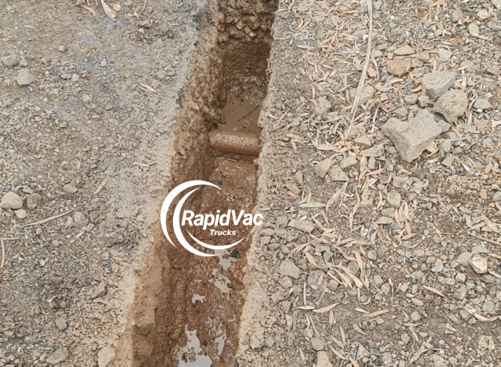
Surveyors often need to locate underground utilities like gas lines, water pipes, or electrical cables before proceeding with measurements or site assessments. Vacuum trucks offer a safe and precise method for exposing these utilities without causing damage.

2. Site Preparation

Clearing debris and soil is often necessary to access critical features of a site. Vacuum trucks streamline this process, creating a clean and safe environment for surveying work.

3. Minimising Environmental Impact

In environmentally sensitive areas, vacuum trucks enable surveyors to clear sites without disrupting the surrounding landscape, ensuring compliance with regulations.

Benefits of Partnering with a Reliable Vacuum Truck Service

For land surveyors, having a dependable vacuum truck partner comes with several advantages:

1. Enhanced Efficiency

Vacuum trucks speed up tasks like utility exposure and debris removal, allowing surveyors to focus on their core responsibilities and complete projects faster.

2. Improved Safety

By using non-invasive excavation methods, vacuum trucks minimise risks associated with traditional digging, such as utility strikes or worker injuries.

3. Access to Expertise

Experienced vacuum truck operators bring valuable knowledge to the table, ensuring that excavation and site preparation are done with precision and care.

4. Cost Savings

Preventing utility damage and reducing project delays result in significant cost savings, making the investment in vacuum truck services worthwhile.

5. Compliance with Regulations

Partnering with a vacuum truck service ensures adherence to local environmental and safety regulations, protecting surveyors and their clients from potential fines or legal issues.

Applications of Vacuum Trucks for Land Surveyors

Vacuum trucks support land surveyors in a variety of applications:

1. Urban Projects

In cities like Sydney and Melbourne, vacuum trucks help surveyors navigate complex underground utility networks, ensuring accurate site assessments for urban developments.

2. Rural and Remote Areas

For projects in Australia’s remote regions, vacuum trucks provide efficient solutions for clearing soil and locating utilities in challenging terrains.

3. Environmental Surveys

In conservation projects, vacuum trucks allow surveyors to work without damaging sensitive ecosystems, maintaining the integrity of the environment.

4. Infrastructure Planning

From roads to railways, vacuum trucks assist in exposing utilities and clearing sites for infrastructure projects, ensuring accurate data collection for planning and execution.

How to Choose the Right Vacuum Truck Partner

Finding the right vacuum truck service is crucial for maximising efficiency and ensuring successful collaborations. Here are some tips for selecting a reliable partner:

  • Experience: Look for providers with a proven track record in supporting land surveying projects.
  • Equipment Quality: Ensure the company uses modern, well-maintained vacuum trucks with advanced features.
  • Skilled Operators: Verify that the team has trained and experienced operators who understand the unique requirements of surveyors.
  • Service Range: Choose a partner that offers flexible and comprehensive services tailored to your needs.
  • Compliance: Confirm that the provider adheres to local safety and environmental regulations.

Why Vacuum Trucks Are Essential for Modern Surveying

As land surveying becomes increasingly complex due to urbanisation, stricter regulations, and environmental considerations, vacuum trucks have become a critical tool. Their ability to perform precise, non-destructive excavation and site preparation aligns perfectly with the evolving demands of the industry.

Establishing a strong partnership with a vacuum truck service not only improves efficiency but also ensures that surveyors can meet client expectations and regulatory requirements with confidence.

Conclusion

For land surveyors in Australia, having a reliable vacuum truck partner is no longer a luxury—it’s a necessity. These powerful vehicles provide the precision, safety, and efficiency needed to tackle the challenges of modern surveying projects. By collaborating with a trusted vacuum truck service, surveyors can enhance their workflows, reduce risks, and deliver exceptional results.

Whether you’re working in urban areas, remote landscapes, or environmentally sensitive sites, a dependable vacuum truck partner will ensure that your projects are executed smoothly and successfully.

FAQs

1. What tasks can vacuum trucks perform for land surveyors?

Vacuum trucks assist with utility exposure, debris removal, site preparation, and working in environmentally sensitive areas, making them invaluable for land surveyors.

2. How do vacuum trucks improve surveying efficiency?

Vacuum trucks speed up tasks like excavation and debris removal, allowing surveyors to focus on core responsibilities and complete projects faster.

3. Are vacuum trucks safe for environmentally sensitive areas?

Yes, vacuum trucks use non-destructive methods that minimise soil and vegetation disruption, making them suitable for sensitive environments.

4. What should surveyors look for in a vacuum truck partner?

Surveyors should prioritise providers with experience, modern equipment, skilled operators, and a strong commitment to safety and compliance.

5. Why are vacuum trucks important for urban surveying projects?

Vacuum trucks enable safe utility exposure and precise site preparation in densely populated areas, reducing risks and ensuring accurate assessments.

Unlocking the Potential of GIS: A Guide to Getting Started

[ad_1]

Unlocking the Potential of GIS: A Guide to Getting Started

Geographic Information Systems (GIS) is a powerful tool for visualizing, analyzing, and managing geographic data and information. GIS has the potential to revolutionize how people interact with their environment, allowing them to explore, analyze, and understand geographic patterns, trends, and relationships. However, many organizations and individuals struggle to unlock the potential of GIS and get the most out of their data. This guide provides an overview of the basics of GIS and offers tips for getting started.

What is GIS?

GIS is a system of tools and methods that allows people to capture, store, manipulate, analyze, manage, and present geographic data. GIS enables users to visualize, explore, and understand the relationships between geographic features and the physical and social environment. GIS can be used to identify patterns, trends, and relationships in data that may not be visible to the naked eye.

Types of GIS Data

GIS data comes in many forms, including aerial photography, satellite imagery, census data, and digital elevation models. GIS also uses vector data, which is composed of points, lines, and polygons that represent geographical features such as roads, rivers, and buildings. Vector data is often used to create maps and other visualizations.

Choosing the Right GIS Software

When getting started with GIS, it is important to choose the right software for the task at hand. There are a variety of GIS software packages available, including open-source and commercial applications. Popular open-source GIS software includes QGIS, GRASS GIS, and OpenJUMP, while popular commercial GIS software includes ArcGIS, MapInfo, and Global Mapper.

Learning GIS

GIS can be complex, and it is important to spend time learning the basics before diving in. Fortunately, there are numerous resources available to help users learn GIS, including online tutorials, courses, and books. It is also useful to attend GIS conferences and workshops to get a better understanding of the technology and network with other GIS professionals.

Integrating GIS with Other Technologies

GIS can be integrated with other technologies, such as remote sensing, global positioning systems (GPS), and geographic databases. This allows users to analyze, visualize, and manage spatial data in more powerful ways. For example, GIS can be integrated with GPS to create real-time location services, or it can be integrated with remote sensing to create detailed land-use maps.

Unlocking the Potential of GIS

GIS has the potential to revolutionize how people interact with their environment, and it is important to take the time to understand the basics before getting started. By choosing the right GIS software, learning the fundamentals, and integrating GIS with other technologies, organizations and individuals can unlock the potential of GIS and get the most out of their data.
[ad_2]

Understanding the Benefits of Contour Surveying for Improved Accuracy

[ad_1]

Understanding the Benefits of Contour Surveying for Improved Accuracy

Surveying is an essential part of any construction or land development project, and the accuracy of the survey data is critical for the success of the project. There are various methods of surveying that can be used, and one of the most effective for accuracy is contour surveying. In this article, we’ll discuss the benefits of contour surveying and how it can help improve accuracy for your project.

What is Contour Surveying?

Contour surveying is a type of surveying that uses lines of constant elevation, known as contour lines, to represent the shape of the land. Contour lines are used to create a two-dimensional map of the land, which can be used to measure distances, angles, and elevations. Contour surveying is used extensively in civil engineering, construction, and land development projects.

Benefits of Contour Surveying

Contour surveying offers several advantages over other types of surveying. Here are just a few of the benefits that it can provide:

1. Improved Accuracy

The most significant advantage of contour surveying is that it can provide much greater accuracy than other types of surveying. The contour lines are measured with a high degree of precision, ensuring that the data provided is extremely accurate. This increased accuracy is especially important for projects involving land development and construction, where small inaccuracies can have a major impact.

2. Cost-Effectiveness

Contour surveying is also much more cost-effective than other types of surveying. The use of contour lines eliminates the need for expensive and time-consuming field surveys, which can be costly and time-consuming. This makes it a great option for projects with tight budgets or deadlines.

3. Easier to Interpret

Contour surveys are much easier to interpret than other types of surveys. The use of contour lines makes it much simpler to visualize the shape of the land and make more accurate measurements. This makes it much easier to identify potential problems or errors before they become costly mistakes.

4. Easier to Update

Contour surveying is also much easier to update than other types of surveys. As the land changes over time, the contour lines can be easily updated to reflect the new terrain. This makes it much easier to keep the survey data accurate and up-to-date.

Conclusion

Contour surveying is an effective and cost-effective way to survey land, and it offers several advantages over other types of surveying. The use of contour lines can provide greater accuracy, cost-effectiveness, easier interpretation, and easier updating. All of these benefits make contour surveying an excellent option for any project that requires accurate surveying data.
[ad_2]

Exploring the Visual Power of Aerial Photography

[ad_1]

Exploring the Visual Power of Aerial Photography

Aerial photography has long been an important tool for capturing the beauty of the world from a different perspective. From capturing stunning landscapes to recording events, aerial photography has been used to document and explore the world in ways that are simply not possible from the ground.

Advantages of Aerial Photography

One of the main advantages of aerial photography is the ability to capture images from a unique, elevated viewpoint. This allows photographers to capture images that are not possible from the ground, revealing patterns and details that would otherwise be hidden from view. Aerial photography can also be used to show the scale of large areas or objects that are difficult to capture from ground level, making it an ideal tool for surveying and mapping.

Aerial photography also has a number of practical applications. For example, it can be used to assess the condition of buildings and other structures, or to monitor changes in land use over time. Aerial photography can also be used in the military, to help with reconnaissance and surveillance operations.

Types of Aerial Photography

There are a number of different types of aerial photography, each with its own advantages and disadvantages. The most common types are conventional aerial photography, oblique aerial photography, and high-altitude aerial photography.

Conventional aerial photography is the most common type of aerial photography and involves taking photographs from a specific altitude. This type of photography is often used for surveying and mapping as it provides a clear view of the area being photographed.

Oblique aerial photography involves taking photographs at an angle, rather than from directly above. This type of photography is often used to capture the details of a particular area or object, such as buildings or landscapes.

High-altitude aerial photography is used to capture images from a much greater height than conventional or oblique aerial photography. This type of photography is often used for surveillance and reconnaissance operations, as it provides a clear view of an area from a great distance.

Equipment and Techniques

Aerial photography requires specialised equipment and techniques in order to capture quality images. The most common type of equipment used for aerial photography is an aerial camera, which is mounted to a fixed-wing aircraft or a drone. The camera is typically controlled remotely, allowing the photographer to adjust the position and angle of the camera while the aircraft is in flight.

Aerial photography also requires the use of different techniques in order to capture the best possible images. For example, photographers must take into account the light conditions when planning a shoot, as different times of day can make a big difference to the quality of the images. Photographers must also consider the angle of the camera, as this will affect the amount of detail that can be seen in the images.

Conclusion

Aerial photography is a powerful tool that has a wide range of applications, from capturing stunning landscapes to surveying land use. There are a number of different types of aerial photography, each with its own advantages and disadvantages. Aerial photography also requires specialised equipment and techniques in order to capture the best possible images. With the right equipment and techniques, aerial photography can be used to capture the world in ways that cannot be seen from ground level.
[ad_2]

What You Need to Know About Legal Descriptions of Property

[ad_1]

What You Need to Know About Legal Descriptions of Property

Property law is an important area of the law, and one of the most important aspects of property law is the legal description of the property. A legal description is a precise description of a piece of land or property that is used for legal purposes, such as in a deed or a mortgage. It is important to understand what a legal description is and how it is used, so that you can understand the legal rights and obligations associated with the ownership of a property.

What Is a Legal Description?

A legal description is a precise description of a piece of land or property that is used for legal purposes. It is used to identify a specific piece of property, and it is used to create a legal record of the property. A legal description is usually written in a standardized format, and it includes information such as the location, the size, and the boundaries of the property. A legal description is typically based on a survey or a map, and it can be used to determine who owns the property and who has rights to it.

Why Is a Legal Description Important?

A legal description is important because it provides an accurate description of a property and can be used to establish ownership, rights, and obligations. A legal description is used when transferring or selling property, and it is also used for taxation and zoning purposes. A legal description is necessary to ensure that all parties involved in a transaction are aware of the boundaries and rights associated with the property.

What Should be Included in a Legal Description?

A legal description should include a variety of information about the property. This includes the location of the property, the size of the property, the boundaries of the property, the ownership of the property, and any special rights or restrictions that may be associated with the property. It is also important to include any details about the surrounding area, such as landmarks, roads, and other properties.

How Is a Legal Description Used?

A legal description is used to identify a specific piece of property and to create a legal record of the property. It is used to establish ownership and rights associated with the property and to ensure that all parties involved in a transaction are aware of the boundaries and rights associated with the property. A legal description is also used for taxation and zoning purposes.

Conclusion

A legal description is an important part of property law, and it is necessary to understand what a legal description is and how it is used. A legal description is a precise description of a piece of land or property that is used for legal purposes, such as in a deed or a mortgage. It includes information such as the location, size, and boundaries of the property, and it is used to establish ownership and rights associated with the property. A legal description is also used for taxation and zoning purposes.
[ad_2]

Exploring the Benefits of Using Elevation Data for Landscape Analysis

[ad_1]

Exploring the Benefits of Using Elevation Data for Landscape Analysis

Elevation data can provide an important source of information when it comes to understanding the geography of an area and its topography. By collecting and analysing elevation data, it is possible to gain a better understanding of the characteristics of a landscape and how it has formed. In the field of landscape analysis, elevation data can be used to detect landforms, calculate surface area, and estimate potential hydrologic behaviors. It can also be used to determine the extent of surface runoff, or to assess the suitability of a location for a particular activity or development.

What is Elevation Data?

Elevation data is a set of numerical values that describe the elevation of a geographic location. This data is usually collected in a digital form, such as a digital elevation model (DEM), and is used to create maps and other visualizations of the topography of an area. Elevation data can be collected using a variety of methods, including aerial photography, satellite imagery, and ground surveys.

Benefits of Using Elevation Data

Elevation data can be used to gain a better understanding of the terrain and landforms of an area. By examining elevation data, it is possible to identify hills, valleys, ridges, and other landforms, as well as to calculate the surface area of an area. Elevation data can also be used to estimate the potential for surface runoff in an area, or to assess the suitability of a location for a particular activity or development.

Elevation data can also be used to create digital terrain models (DTM), which can be used to simulate different scenarios, such as land use changes or the effects of climate change. DTMs can be used to identify areas that are prone to flooding or landslides, or to assess the potential for erosion or other land degradation.

Applications of Elevation Data

Elevation data can be used in a variety of applications, including hydrological modeling, transportation planning, land use planning, and natural resource management. For example, elevation data can be used to create flood maps, which can be used to inform emergency management and mitigation efforts. It can also be used to create models that predict the impacts of climate change on an area, such as the potential for sea-level rise.

Elevation data can also be used to create digital elevation models (DEMs) for various types of analysis, such as hydrological modeling, land use modeling, and habitat suitability analysis. DEMs can be used to assess the potential for surface runoff, erosion, or other land degradation, or to identify areas that are prone to flooding or landslides.

Conclusion

Elevation data is an important source of information when it comes to understanding the geography of an area and its topography. By collecting and analysing elevation data, it is possible to gain a better understanding of the characteristics of a landscape and how it has formed. Elevation data can be used in a variety of applications, such as hydrological modeling, transportation planning, land use planning, and natural resource management. By using elevation data, it is possible to gain a more comprehensive understanding of an area and its potential for various activities and developments.
[ad_2]

Navigating the Landscape: The Benefits of Geodetic Devices

[ad_1]

Navigating the Landscape: The Benefits of Geodetic Devices

In the modern world, it is essential for businesses to accurately map and measure their physical environment. Geodetic devices are a powerful tool for helping to do just that. A geodetic device is a device used for measuring and mapping the curved surface of the Earth, and it includes features such as GPS, digital mapping, and aerial photography. With the help of geodetic devices, businesses can easily measure distances, angles, and directions in order to accurately map their physical environment.

Geodetic devices can be used for a variety of applications, such as surveying, mapping, navigation, and cartography. Surveyors use geodetic devices to measure distances, angles, and directions in order to map out parcels of land. Mapping professionals use them to create digital maps or aerial photographs. Navigation systems rely on geodetic devices to accurately calculate distances and directions between two points. Finally, cartographers use them to create visual representations of physical spaces.

The Advantages of Geodetic Devices

Geodetic devices offer many advantages for businesses and professionals. First, they are incredibly accurate and precise. Geodetic devices can measure distances and angles with an accuracy of up to a few centimeters. This level of accuracy is essential for businesses that need to accurately map and measure their physical environment.

Second, geodetic devices are easy to use. They have intuitive user interfaces and are simple to operate. This makes them ideal for businesses that don’t have the time or resources to invest in complex, expensive surveying equipment.

Third, geodetic devices are cost-effective. They are much more affordable than traditional surveying equipment and can be used for a variety of different applications. This makes them ideal for businesses that need to quickly and accurately map their physical environment on a budget.

The Limitations of Geodetic Devices

Despite the many advantages offered by geodetic devices, there are a few limitations that should be taken into consideration. First, geodetic devices are limited in terms of the accuracy of their measurements. While they are accurate enough for many applications, they are not as accurate as traditional surveying equipment.

Second, geodetic devices are not suitable for all applications. For example, they are not suitable for highly precise measurements such as those used in engineering or construction projects.

Finally, geodetic devices are not always reliable. They can be affected by environmental factors such as interference from nearby objects or changes in the weather.

Conclusion

Overall, geodetic devices are a powerful tool for businesses and professionals who need to accurately map and measure their physical environment. They are easy to use, cost-effective, and accurate enough for many applications. However, they are limited in terms of accuracy and reliability and are not suitable for all applications. It is important to consider these limitations when deciding whether or not to invest in geodetic devices.
[ad_2]

Understanding the Benefits of GPS Surveying Devices

[ad_1]

Understanding the Benefits of GPS Surveying Devices

GPS surveying devices are becoming increasingly popular for a variety of surveying tasks. These devices provide a more accurate and efficient way to measure distances, angles, and other geographic features. In this article, we will discuss the benefits of using a GPS surveying device as well as some of the most common applications.

Benefits of GPS Surveying Devices

GPS surveying devices offer a number of benefits that make them more desirable than traditional surveying methods. The most notable benefit is the accuracy of the data produced. GPS surveying devices are able to produce results with a margin of error of less than one meter. This is much more accurate than traditional surveying methods, which typically have a margin of error of several meters.

GPS surveying devices are also much faster and more efficient than traditional methods. They can be used to take measurements in a fraction of the time that it would take to do the same job with traditional surveying methods. This makes them ideal for large-scale projects that require quick results.

GPS surveying devices are also much more cost-effective than traditional methods. They require fewer personnel and less equipment, and the results are more accurate. This makes them a great choice for projects that need to be completed quickly and without breaking the bank.

Common Applications of GPS Surveying Devices

GPS surveying devices can be used for a variety of tasks. They are most commonly used for mapping, surveying, and navigation. They can also be used for geological and geophysical exploration, as well as for measuring distances, angles, and other geographic features.

Mapping is one of the most common applications for GPS surveying devices. They are used to create accurate maps of large areas, such as cities, forests, and oceans. They can also be used to map out roads, rivers, and other features.

Surveying is another common application of GPS surveying devices. They are used to measure distances, angles, and other geographic features. This data can then be used to create accurate maps, as well as to calculate land boundaries and other important measurements.

GPS surveying devices are also used for navigation purposes. They can be used to track a person’s location or to create a navigational route. This can be useful for search and rescue operations, as well as for recreational activities such as hiking and camping.

Conclusion

GPS surveying devices offer a number of benefits that make them more desirable than traditional surveying methods. They are more accurate, faster, and more cost-effective. They can be used for a variety of tasks, including mapping, surveying, and navigation. With the increasing popularity of GPS surveying devices, it is important to understand the benefits and common applications of these devices.
[ad_2]

A Comprehensive Guide to Topographic Surveys for Land Planners

[ad_1]

A Comprehensive Guide to Topographic Surveys for Land Planners

Topographic surveys are an essential part of land planning and development. They are used to determine the elevation of the land, as well as the features that exist on the land, such as buildings, roads, rivers, and other features. In this guide, we’ll discuss what topographic surveys are, why they are important, and how to obtain them.

What is a Topographic Survey?

A topographic survey is a type of survey that creates an accurate three-dimensional representation of the land. It is used to determine the elevation of the land, as well as the features that exist on the land, such as buildings, roads, rivers, and other features. The survey will also create a map that shows the contours of the land, which can be used to create a plan for land development.

Why is a Topographic Survey Important?

A topographic survey is important for land planning and development because it allows land planners to accurately assess the characteristics of the land before they begin any development. It can help them identify potential issues with the land, such as flooding, soil erosion, or other environmental hazards. It also allows them to create an accurate plan for development, including where roads, buildings, and other features will be located.

How to Obtain a Topographic Survey

In order to obtain a topographic survey, you will need to hire a professional surveyor. The surveyor will use special equipment to measure the elevation of the land, as well as the features that exist on the land. This information will then be used to create a map that shows the contours of the land.

Using Topographic Surveys for Land Planning

Once you have obtained a topographic survey, you can use it to create a plan for land development. The map created from the survey will provide you with a visual representation of the land, which will allow you to identify potential issues and plan accordingly. You can also use the survey to determine where roads, buildings, and other features should be placed.

Conclusion

Topographic surveys are an essential part of land planning and development. They are used to determine the elevation of the land, as well as the features that exist on the land. A professional surveyor can be hired to obtain a topographic survey, which can then be used to create a plan for land development. By understanding the importance of topographic surveys and how to obtain them, land planners can ensure that their projects are successful.
[ad_2]

How to Accurately Locate Property Boundaries Through Boundary Surveying

[ad_1]

How to Accurately Locate Property Boundaries Through Boundary Surveying

Property boundary surveying is a process that identifies the exact location of property lines and the features that define them. It is a necessary step in real estate transactions, as it ensures that all parties involved understand the exact boundaries of the property in question. It is also used to determine the size of a property, as well as its location relative to other properties. Property boundary surveying is a complex process that requires the expertise of a professional surveyor.

Steps Involved in Boundary Surveying

The steps involved in boundary surveying can vary depending on the size and complexity of the property in question. However, the basic steps are the same for all boundary surveys. These include:

1. Establishing the Property Lines

The first step in boundary surveying is to establish the property lines. This is done by examining existing survey maps, deeds, and other documents that define the property boundaries. The surveyor will also use field notes, aerial photographs, and other methods to accurately determine the boundaries of the property.

2. Researching and Locating Evidence

Once the property boundaries have been established, the surveyor will need to research and locate any evidence that can help to identify and verify the boundaries. This can include researching historical records, examining aerial photographs, and visiting the property to search for any physical evidence that can help to verify the boundaries.

3. Identifying Landmarks and Marking Boundaries

The next step is to identify any physical landmarks that can be used to verify the boundaries. This includes examining existing fences, walls, trees, and other features that can help to identify the boundaries. The surveyor will then mark the boundaries with flags, stakes, or other markers.

4. Creating a Survey Map

The surveyor will then create a survey map that accurately reflects the boundaries of the property. This map will include any landmark features, boundary markers, and other information that can help to verify the boundaries. The surveyor will then submit the map to the local government for approval.

5. Finalizing the Survey

Once the map has been approved, the surveyor will finalize the survey by gathering all of the necessary documents and verifying that the boundaries are accurate. This includes verifying that the boundaries on the map match the physical boundaries of the property. If any discrepancies are found, the surveyor will need to adjust the boundaries accordingly.

Benefits of Boundary Surveying

Boundary surveying is an important process that helps to ensure that all parties involved in a real estate transaction understand the exact boundaries and features of the property. By accurately determining the boundaries, surveyors can also help to ensure that no disputes arise regarding the property’s borders. Furthermore, boundary surveys can help to protect both buyers and sellers from potential boundary disputes in the future.

Conclusion

Boundary surveying is a complex process that requires the expertise of a professional surveyor. By following the steps outlined above, surveyors can accurately determine the boundaries of a property and create a survey map that accurately reflects the property’s borders. This can help to ensure that all parties involved in a real estate transaction understand the exact boundaries of the property and can help to prevent any future disputes.
[ad_2]