
For millennia, surveyors have fulfilled the need to mark property boundaries and conduct reconnaissance. Today, this essential work has expanded to include managing, interpreting, analysing and portraying spatial information.
Surveying is an important part of a number of different industries, from land management to construction to agriculture. These industries all require accurate, timely and user-friendly geospatial data.
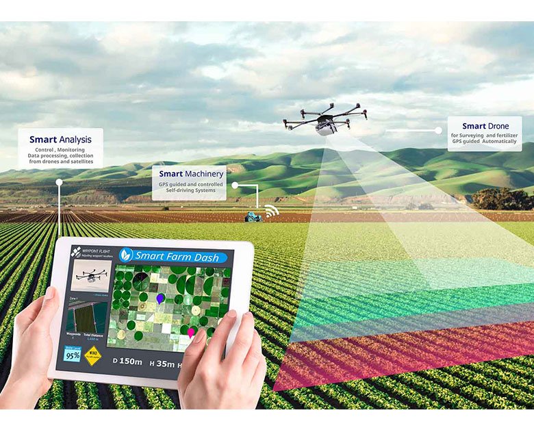
Drones and UAVs
Drones and Unmanned Aerial Vehicles (UAVs) are rapidly transforming the future of land surveying. They are capable of mapping large plots of land in minutes, which is faster than traditional methods.
UAVs are also able to provide centimeter-level accuracy, as they fly much closer to the ground than satellites or manned aircraft can. This allows drone surveyors to deliver detailed geo-data on every pixel of a map or point on a 3D model.
This can make it easier for land managers to make informed decisions about their properties, such as where to build roads, irrigation systems, and other projects. They can also collect data about the land’s water sources, elevation, and geological makeup that may otherwise be difficult to obtain.
As a result, surveyors can spend less time on field work and more time on analysis. This can help to reduce costs, which is especially important for land management.
Total Robotic Stations
A robotic total station is a remote-operated instrument that only requires one operator and is capable of performing far more calculations and inspections than traditional total stations. This technology can save time and money on site, as well as reduce rework on construction projects.
For example, it can record up to 600 points per day compared to 250-400 with a mechanical total station. This can help to improve efficiency and ensure that your project is completed on schedule.
In addition to measuring angles, distances and slopes, the robot can also scan areas for construction debris and other obstructions. This feature is particularly helpful in surveying areas with high ponds, or on construction sites where large pieces of equipment can interfere with the surveyor’s line of sight.
A variety of communication technologies are available for synchronizing the robotic total station and the prism pole. These include developments like LongLink Bluetooth tech-nology. This means that the total station can automatically follow the prism as it moves through 3D space, and the prism can be easily traced if it loses contact with the instrument.
Laser Scanning
Laser scanning is a form of 3D imaging that uses a light source to project precise data points. This creates point clouds – millions of precisely measured XYZ points that define the position and shape of an object or space.
The data gathered is used in a variety of ways, including in construction projects, engineering and building applications. As a result, laser scanning is a very effective way to complete a wide range of projects quickly and with remarkable accuracy.
A key benefit of this technology is its ability to capture and document real-world elements within a structure, such as outlets, pipe beams, fixtures, etc. This documentation can then be used in BIM or AutoCAD to help plan the project and avoid costly rework later on.
Surveying firms that integrate laser scanning into their workflows can develop new services and higher value deliverables. This helps clients get the information they need and provides a competitive edge.

